
Read the mountain
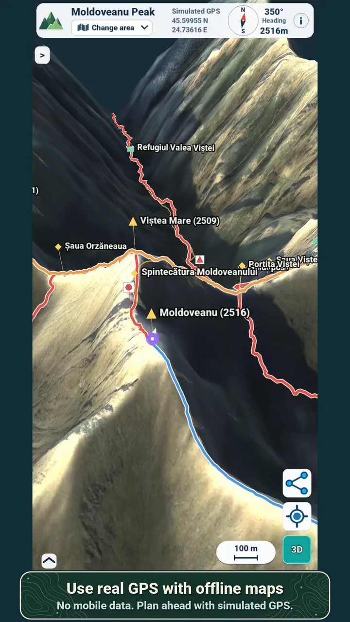
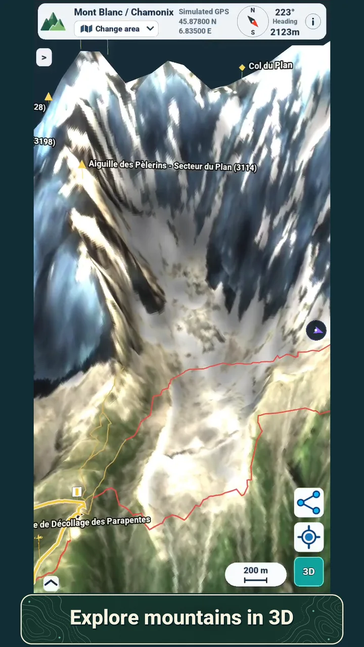
Turn satellite imagery and elevation data into a 3D view of ridges, valleys and approaches.
OFFLINE HIKING MAPS FOR THE CURIOUS
Explore mountain terrain in 3D, compare mapped routes, and carry the map into the field. Your downloaded maps and real GPS work without mobile data.
A DIFFERENT WAY TO PREPARE
For the weekend trail you know by heart, or the mountain you have only seen on a map. Hedda gives the terrain, the paths and the useful places room to make sense.
Turn satellite imagery and elevation data into a 3D view of ridges, valleys and approaches.
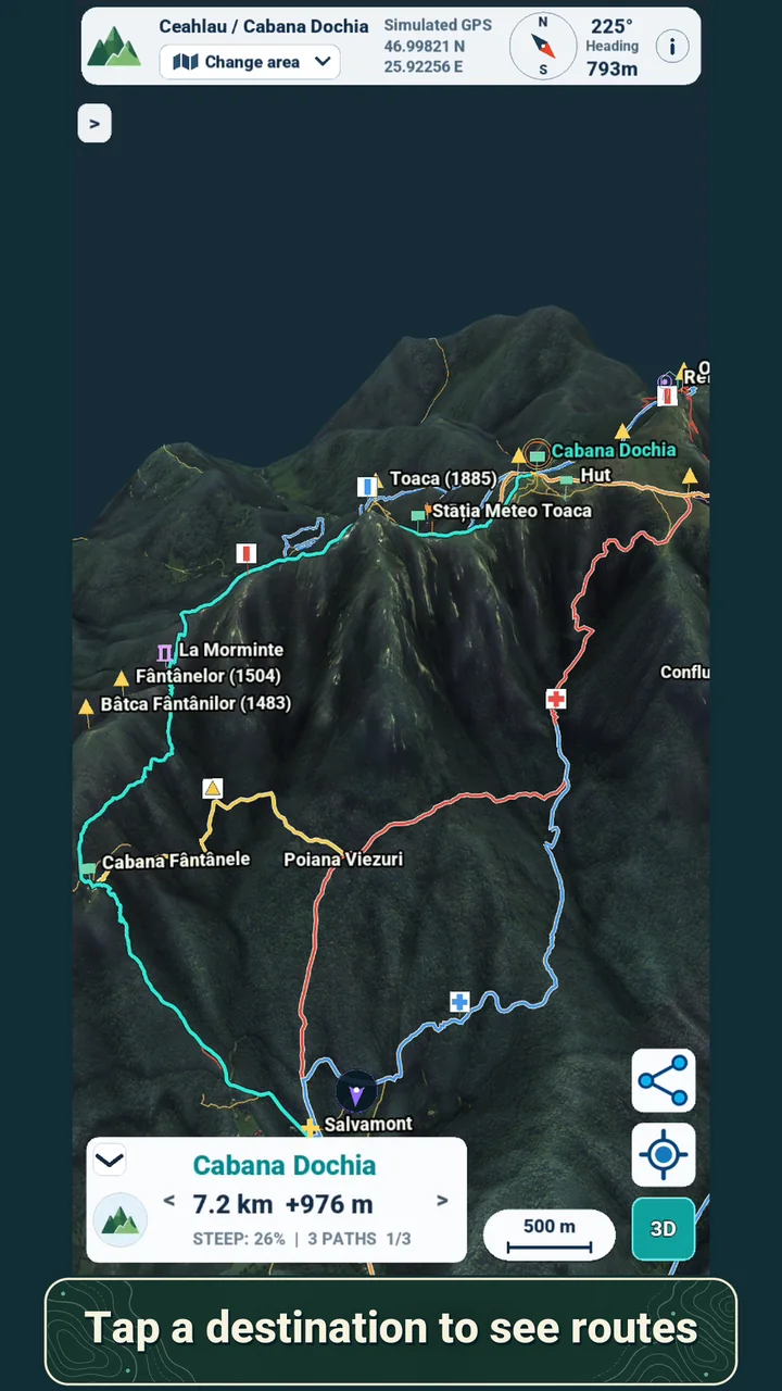
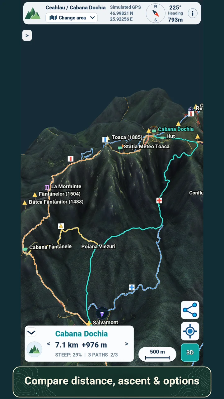
Tap a destination and explore available mapped paths with distance, climb and steepness.
Download the map before leaving. Follow your GPS position even without mobile data.
ROUTE PLANNING
Choose a peak, hut or another objective. When mapped paths connect to it, Hedda highlights a route from your current or simulated location.
Route availability depends on mapped trail data. Hedda is a planning aid, so always check conditions on the ground.
MADE TO GO BEYOND COVERAGE
Save a map to your device while you have internet. Out on the trail, the map stays available and your phone's real GPS can show where you are without a mobile data connection.
Download before you go
Choose a ready-made map or build your own.
Plan from anywhere
Double-tap to place a simulated GPS point and preview routes.
Find your position outside
Use real GPS with a map already on your device.
The footage shown uses simulated GPS for planning. Creating and downloading new maps needs an internet connection.
YOUR MAP, YOUR FOCUS
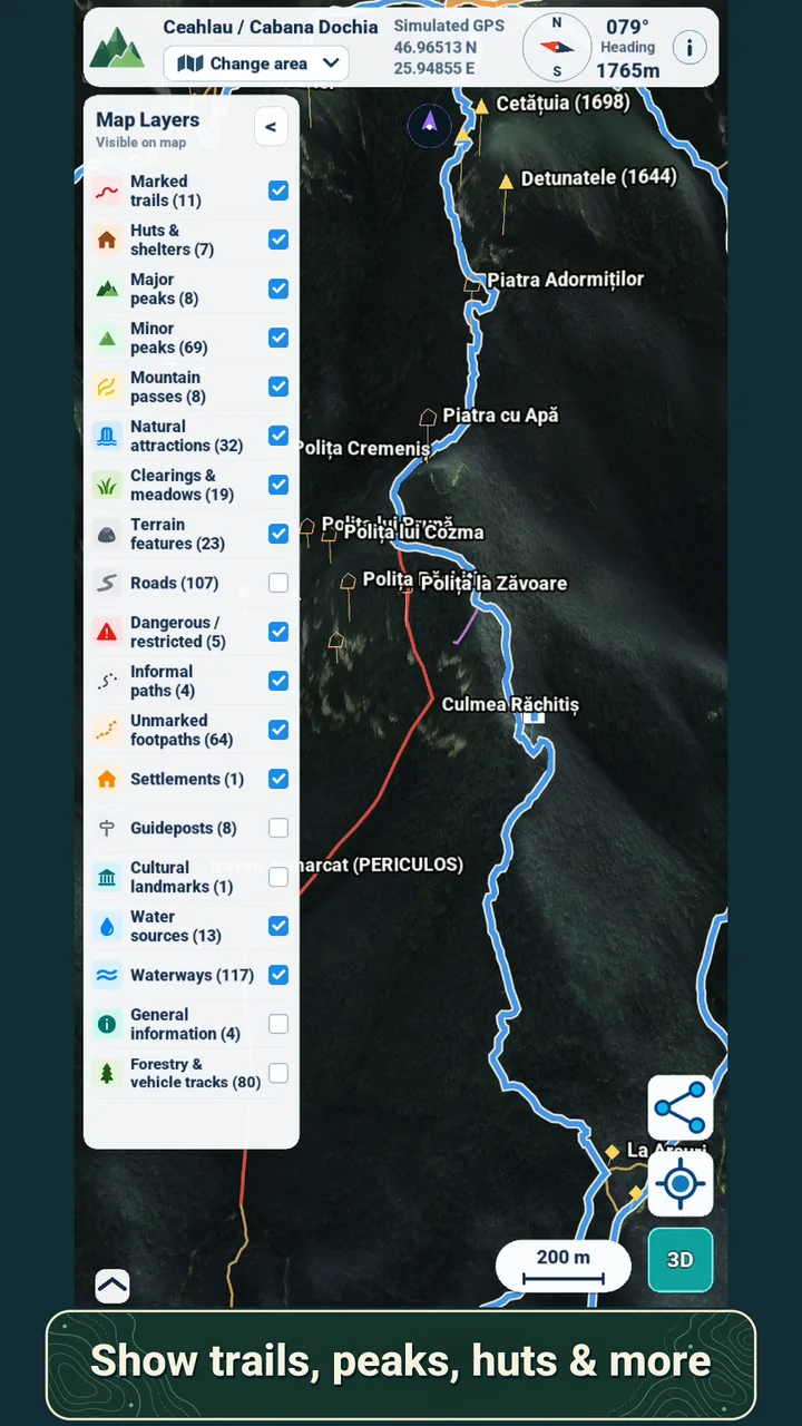
Keep the view calm or fill it with useful clues. Toggle categories to see the landscape your way.
Routes and points of interest are based on available OpenStreetMap data.
THE NEXT PLACE IS YOURS
There are ready-to-download maps for a fast start. For the place on your own wish list, draw a new area and let Hedda prepare it.
Begin with included Romanian mountain areas, then browse free maps across Europe and beyond. Download what interests you and keep it on your device.
A good first step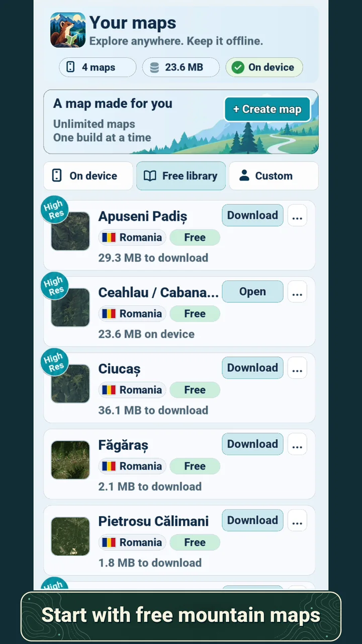
Pick a rectangular area anywhere in the world. Submit it for building, carry on using Hedda, then download the map when it is ready.
Custom areas worldwide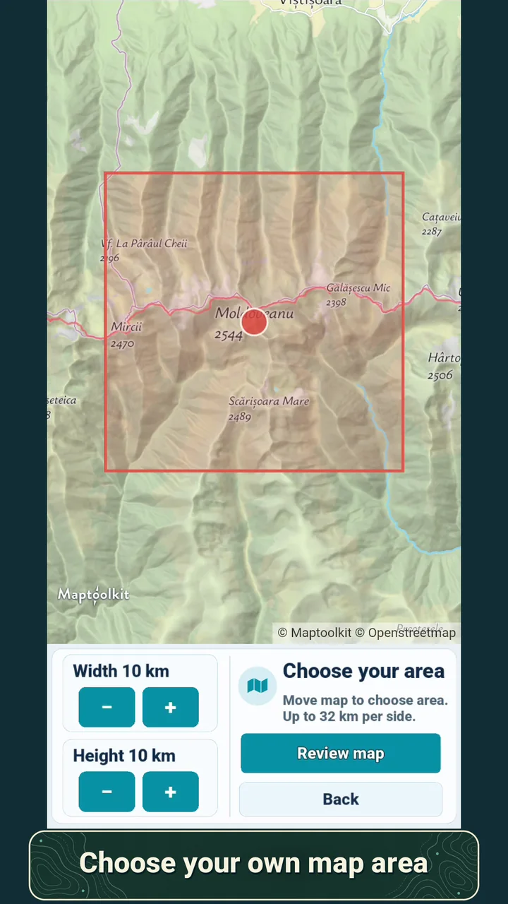
Premium adds high-resolution imagery in supported areas: all of Romania for now, with more countries planned. Each high-resolution custom map can cover up to 100 square kilometres.
Romania now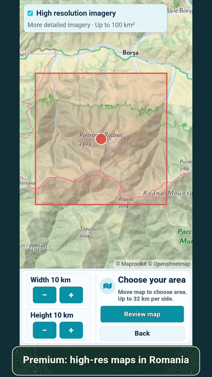
TAKE A CLOSER LOOK
Drag or swipe to explore
HEDDA IN MOTION
Watch 45 seconds of 3D mountain views, mapped routes, layers and custom areas.
Watch the trailerEASY TO START
Try a ready-made map, explore the terrain and see how it fits your next hike. Build your own area when you need something more specific.
GOOD TO KNOW
No. Once a map is on your phone, you can view it offline and use real GPS to see your position. You need internet to request, build or download a new map.
Yes. Double-tap a spot on the map to set a simulated GPS position. You can then preview available routes from that point.
Choose a rectangular area anywhere in the world. Free accounts can request one custom map per week up to 16 x 16 km. Larger areas and more creation are available with Premium.
New packages are prepared on a server, so you need internet to submit a request and download the result. You can continue using the app while a map is being prepared or queued. Premium server copies have a 100 MB storage limit and expire after seven days; maps already downloaded remain on your device.
Trails and points of interest are drawn from available OpenStreetMap data. Satellite imagery is based on Sentinel-2, with elevation from Copernicus data. Coverage and route availability vary by area.
THE NEXT RIDGE IS WAITING
Start with a free mountain map. Plan from home, then bring the terrain with you.